Product Description
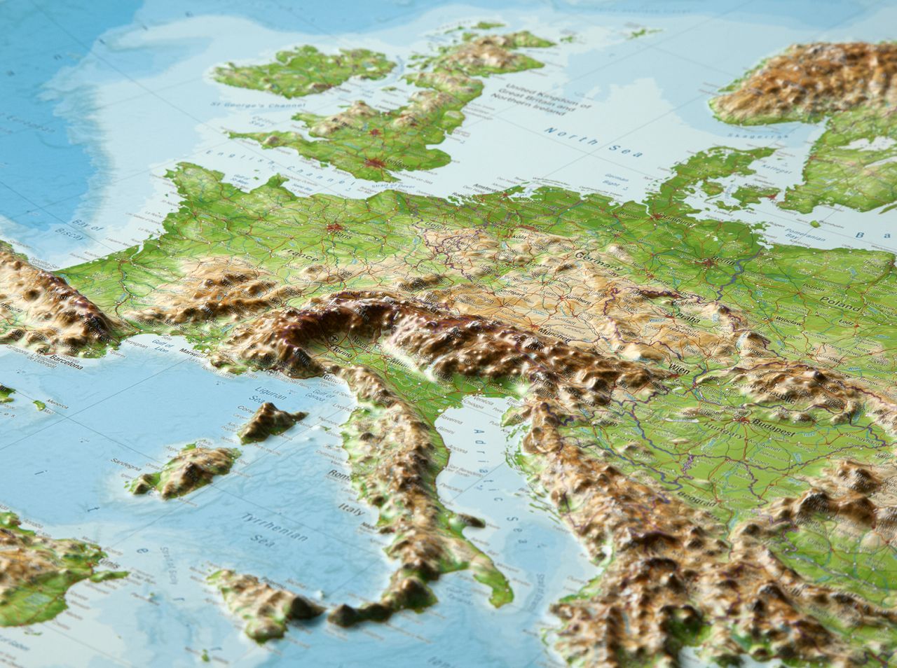
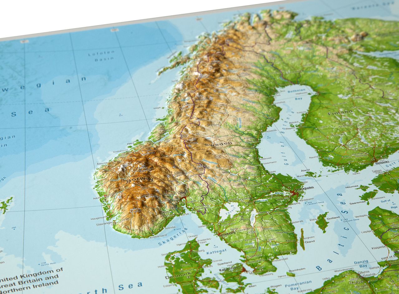
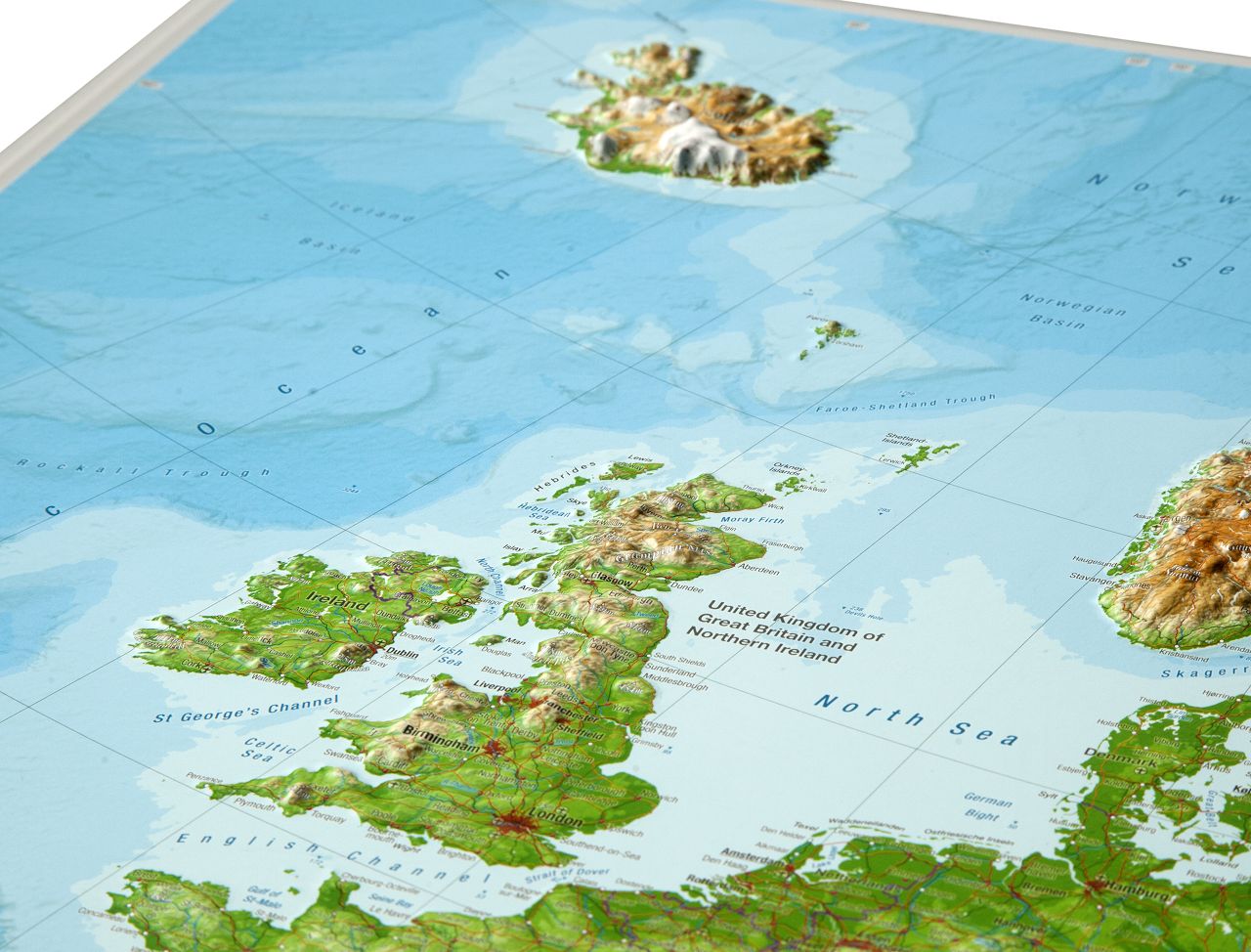
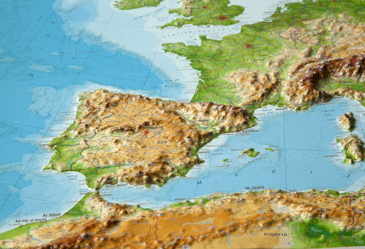
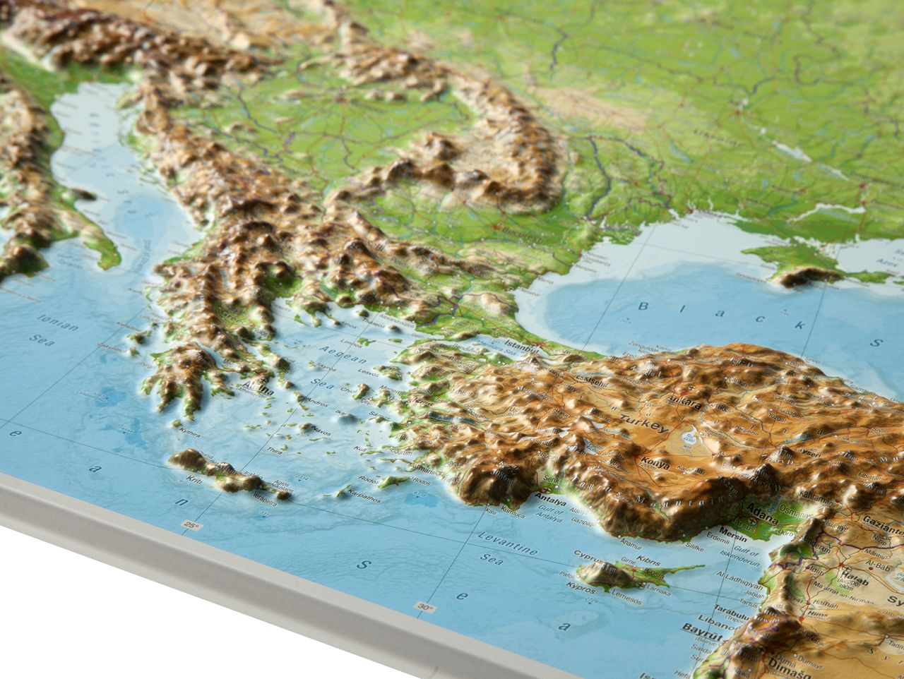
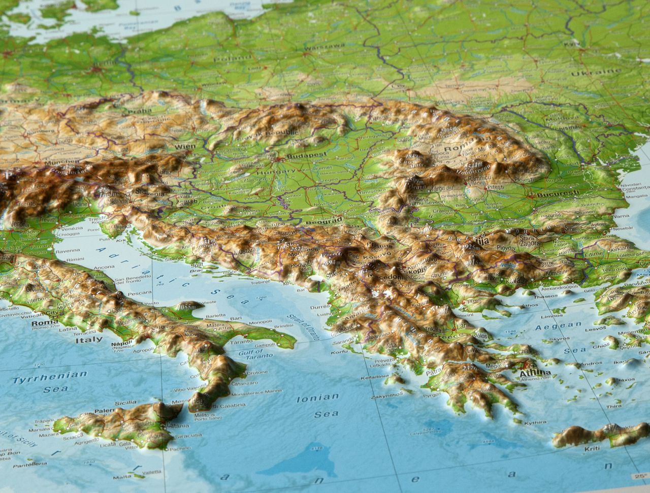
Discover Europe like never before with this meticulously crafted 3D Raised Relief Map, designed for geography enthusiasts, travelers, educators, and anyone fascinated by the diverse landscapes of this remarkable continent. This stunning map offers a tactile, three-dimensional experience that brings Europe’s varied terrain to life, showcasing everything from the towering peaks of the Alps to the rolling plains of Eastern Europe.
Key Features:
- High-Quality Craftsmanship: Each map is made from durable, lightweight materials, ensuring both aesthetic appeal and longevity. The raised relief effect is created using precise topographic data, resulting in an accurate and detailed representation of Europe’s geographical features.
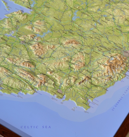
- Detailed Terrain: Experience the continent’s diverse topography, with mountains, valleys, and rivers clearly defined. The map features all major mountain ranges, including the Alps, Pyrenees, and Carpathians, as well as major rivers like the Danube, Volga, and Rhine.
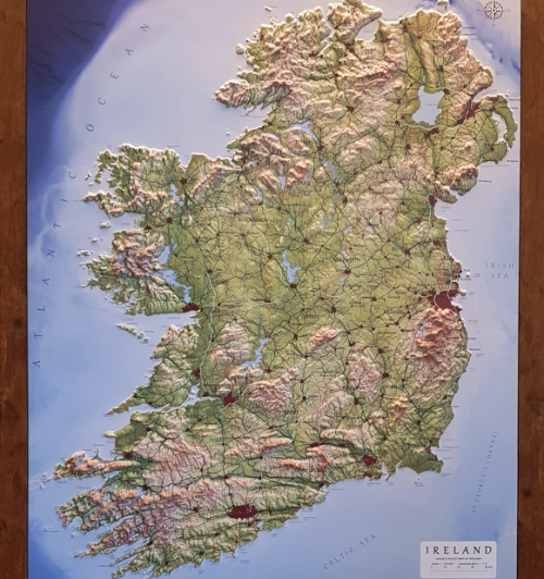
- Educational and Decorative: Perfect for classrooms, offices, or home decor, this 3D map serves both educational purposes and as a striking decorative piece. It’s an excellent tool for students and teachers, enhancing the learning experience with a hands-on approach to geography.
- Vibrant Colors and Clear Labels: The map uses vibrant, eye-catching colors to differentiate between various altitudes and landscapes. Each country, major city, and natural landmark is clearly labeled, making it easy to identify regions and understand the physical geography of Europe.
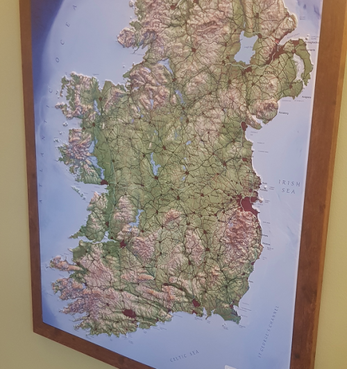
- Ready to Display: The map comes ready to hang with mounting hardware included, making it easy to display on any wall. Its lightweight design ensures it can be mounted safely in any space.
- Sizes and Customization: Available in multiple sizes to suit any space, from small desks to large wall installations. Custom options are also available for those who want to personalize their map with specific labels or regions of interest.
- Perfect Gift: A thoughtful gift for travelers, map enthusiasts, teachers, or anyone with a passion for geography. It’s not just a map; it’s a piece of art that inspires exploration and learning.
Description
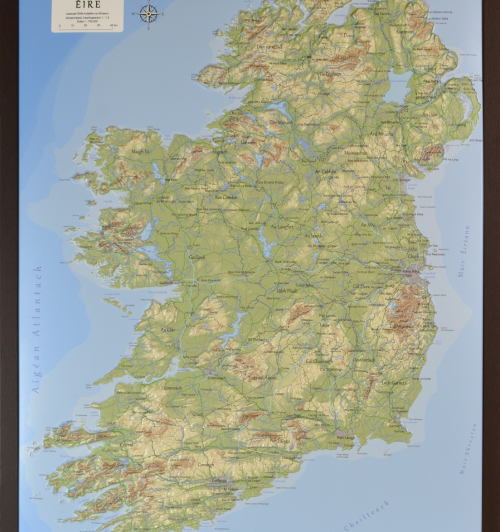
3D Raised Relief Map Europe Large
– Dimensions: 770 x 570 x 20mm
– Scale: 1: 8,000,000
– Superelevation: approx. 20-40 (logarithmic)
The map of Europe stretches from the Urals in the east to the Atlantic in the west.