Maximum Model Size
The size of a printed 3D-printed model is limited by the build volume of the 3D printer. A typical build volume of many of the consumer-type 3D printers on the market would be approximately 210 x 210 x 200 mm. However, this is would make for quite a small 3D relief map! The advantage with our method is that we are not limited by the build volume of our 3D printer.
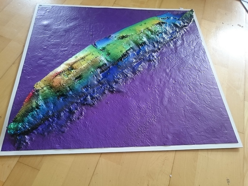
Large models – over 600 x 600 mm can be produced by building the landscape in sections up to the required size and assembling these sections in a single model. We then form a continuous plastic sheet over the assembled sections thereby obscuring the joins on the model. The maximum size we can produce by this method is 640 x 610 mm. Check out the model of the wreck of the Lusitania we did for the Geological Survey of Ireland!
Short Runs or Mass Production
The 3D printed models we produce can withstand only a limited number of passes before they begin to deteriorate. The deterioration is caused by the high temperature and pressure applied to the model during the forming process. This means we can produce two to three copies of the product relatively cheaply. If a larger number of copies are needed, further tooling steps would be required, adding significantly to the cost. However, once the tooling has been created it would be possible to reproduce an indefinite number of products at a much lower per-unit cost.
Map Image or Aerial Photographs
Although it is possible to produce colour 3D printed models the quality of the resulting image is low. With our method of printing a full-colour high-definition image onto a flat plastic sheet using a wide format digital printer and then forming this image over the model, we end up with a much higher quality end-product. It is possible to overlay whatever image or images our clients require, including highly detailed aerial photographs or maps. There are a number of options available:
- We can use client provided images; maps or aerial photos
- Terraform can design maps using existing open-source datasets and in-house design
- Terraform can source OSI (or other) mapping/aerial photos
- In collaboration with our surveying partner we can produce site specific aerial photos
GIS Services
Terraform also provide advanced GIS mapping services to the private and public sectors. Just get in touch with your enquiry and we will see how we can help you out with your mapping/modelling project.