Killary Harbour is one of only two Fjords in Ireland, the other being Carlingford Lough between County Down and County Louth. A Fjord is formed by glacial erosion – specifically, when a glacier erodes a U-shaped valley which is subsequently flooded by rising sea levels.
On the north shore of the harbour is the Mweelrea Mountain range, with Mweelrea Mountain itself being the highest peak in Connacht at 814 m. The south shore is flanked by the Maumturks and the Twelve Bens, rising to 702m and 729 m respectively, making the Killary Harbour and surrounding area a dramatic and stunning landscape.
If you travel along the south shore of the 16 km long harbour looking north, you will see corries and hanging valleys perched high on the valley wall on the opposite shore. There is an old famine road which leads to the townland of Foher with a number of old cottages that were abandoned during famine times.
The Wild Atlantic Way route joins Killary Harbour from the south along the N59 and continues east toward Leenane before rounding the eastern end of t he harbour at the beautiful Aasleagh waterfalls. From there you head west along the R335 before the road turns north through the steep valley between Ben Gorm and Mweelrea.
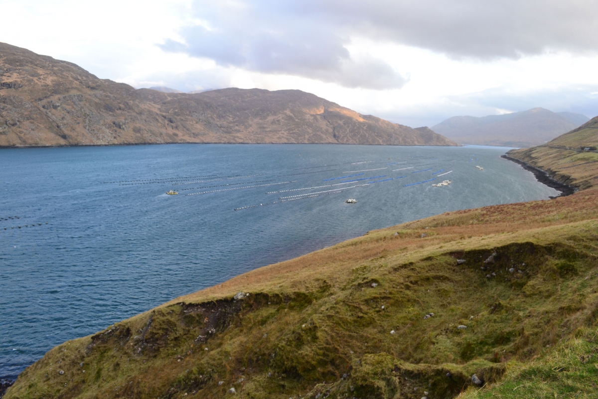
The calm waters of the harbour make it an ideal place for mussel rafts and fish cages and you can often see boats heading out to service these structures. These fish and mussel farms are an important source of income for the local economy. However, tourism is now probably the biggest local employer. A 90 minute Killary Harbour boat trip is probably one of the best ways to experience this beautiful landscape.